An associated quasi-stationary front down south of Oklahoma will interact with increasing moisture, producing showers and thunderstorms over our region tonight, and into tomorrow. These storms are not forecasted to be severe. A few claps of thunder, and some heavy rain at times is what you can expect. Good Sleeping weather. All this happens after 10pm. expect 1-1.5 inches of rain.
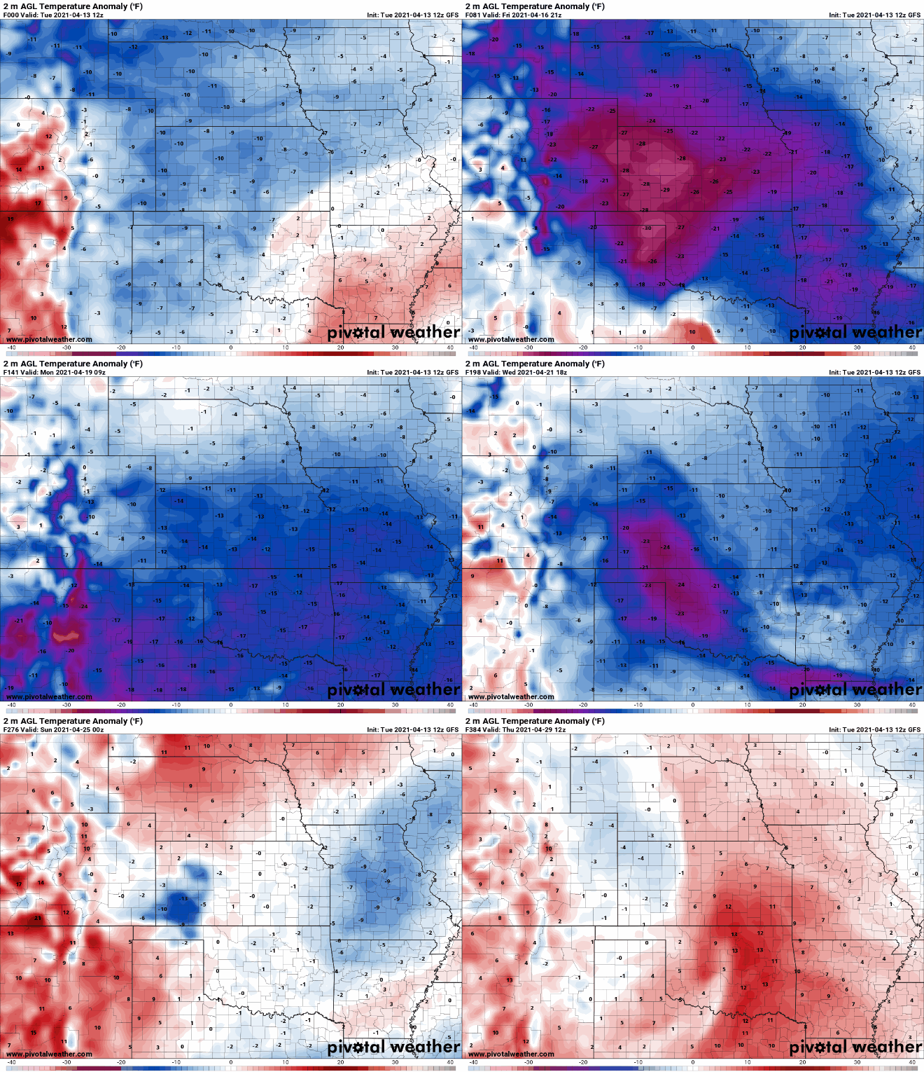
Folks, we are going to be stuck in more of cooler pattern for the next week, or so. Hope you weren’t wanting a big warm-up, because it isn’t happening. Well, at least, not in the next 7 days. It won’t be much longer, and you’ll start to hear how hot it is.
The map you are looking at over to your left is what they call Temperature Anomaly. In the simplest terms, it’s the departure from normal temperature. Blue is colder. Red is warmer. White is normal. We have a lot of blue over the entire 384 hour (16 day) model run. Over the next week we are going to have trouble seeing temps get into the 70’s. Chilly mornings. Chilly evenings. Some of that jacket on; jacket off weather.
There are some very cool nights in store for us over the next few weeks. 1 of those nights could dip down to 32. Cold enough for a light frost, and enough to damage more sensitive plants. Here in weather world we deal in probabilities, and that is what we have on the top. From April 11th to April 15th the chances of a frost drops 10%. The bottom graphs details reports related to late fros,t and freezes.
I will keep you all updated if a frost/freeze looks probable.